Oneonta's Parks
Neahwa and Catella Park
Map of Neahwa and Catella Parks
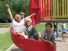
Oneonta's largest and most active park is located within easy walking distance of the downtown area. At the heart of Neahwa Park is historic Damaschke Field, home of the New York Collegiate Baseball League's Oneonta Outlaws. Neahwa Park's other facilities include a lighted softball facility, a skateboard park, tennis and basketball courts, a sand volleyball court, picnic pavilions (reservations recommended), numerous multi-purpose fields, playground structures, and the picturesque Hodges Pond. Adjacent to Neahwa Park, Catella is home to multi-purpose fields used for baseball, softball, and soccer.
Directions:
From I-88 East—Use exit 14. Turn left at bottom of exit ramp onto Main Street. Turn right at the first light and proceed to western park entrance.
From I-88 West—Use exit 15. Turn right at the bottom of exit ramp and merge onto Lettis Highway. Move to the left lane. At the first light turn left onto Main Street. Take the first left onto Grand Street. Take the first right onto Division Street. At the end of Division Street take a right. Take the next left onto James Georgeson Drive and proceed to the northern park entrance.
Neahwa and Catella Park Facilities
Damaschke Field
Renovated in 2007, Damaschke Field maintains an historic, small town feel in a modern baseball stadium. Damaschke Field is the home of the New York Collegiate Baseball League's Oneonta Outlaws. For information regarding playing a game or hosting an event at Damaschke Field, contact the Outlaws at 607-432-6326.
Theodore "Ted" Christman Field (#4)
During the spring and summer seasons Christman Field serves as the city's premier softball field. In the fall the field can be converted for youth soccer or football. This lighted facility's amenities include a concession stand, press box, scoreboard, and restrooms. Reserved usage is available.
Fee schedule - $50 per day, plus $100 for light usage.
Neahwa Park Field #6
A professional grade baseball field located across the street from Damaschke Field. These two baseball facilities make Neahwa Park an ideal setting for tournaments. Field 6 amenities include dugouts, electronic scoreboard, bleachers, nearby restrooms, and ample parking. Fee schedule - $150 per four hour time block.
Skateboard Park
The only facility of its kind in the area, the Neahwa Park Skateboard facility was constructed in cooperation with the Oneonta Community Alliance for Youth (OCAY) and the Oneonta Job Corps Academy.
Brenner Recreation Center
Adjacent to picturesque Hodges Pond, the Brenner Building houses the Parks Department's administrative offices (temporarily closed) and the Laskaris Skateroom. In addition to being a place to warm up when skating is offered on the pond, the skateroom is used year round as a staging area for park events.
Bandstand
The city's mobile bandstand is set up each year on the east side of Hodges Pond and hosts the Summer Concert Series on Thursday nights from late June through mid-August.
Mill Race Trail
The Mill Race trail lies along the northern border of Neahwa Park, extending a quarter mile from the Damaschke Field parking lot to the park's western entrance. Future plans for the trail include adding a hardened surface which will make the facility fully handicapped accessible. In its current state, the trail provides a serene pathway between Neahwa Park's two entries. Its short length and level grade also make it ideal for introducing children to nature walking or mountain bilking.
Catella Park
Accessed via David Brenner Road, Catella Park is home to several multi-use athletic fields. In the spring and summer these are configured for baseball and softball. For the fall season, Catella Park's fields are configured for use by the Oneonta Youth Soccer Association. Fishing access to the Mill Race stream is available from Catella Park.
Catella Park/New Island Greenway
The trailhead for the Catella Park/New Island Trail is located at Catella Park's northeast corner. Permissible uses of the trail include hiking, mountain biking, snow shoeing and cross country skiing. Downloads: Trail Map - Trailhead Sign
Veteran's Memorial Walk
This new pedestrian promenade gives prominence to the host of historical markers and memorials that surround Hodges Pond.
Wilber Park
Map of Wilber Park
Located near downtown Oneonta, the upper level of this park can be accessed via Center Street and has a large picnic pavilion, basketball court, modern playground structure and the beautiful Applebaugh Gardens. The lower level is accessed via Spruce Street and includes a small picnic pavilion, Briggs Swimming Pool, the George Waddington Tennis Courts, and two multi-use practice fields. Intermingled throughout Wilber Park's 56 acres are a host of quiet walking and biking trails.
Directions:
From I-88—Use exit 15. From the bottom of the exit ramp turn onto Lettis Highway (Left turn if exiting 88 eastbound, right if exiting westbound). After the first light, Lettis Highway becomes Maple Street. At the second light turn right onto Center Street.
To access Upper Wilber Park—Continue straight on Center Street up the hill. Upper Wilber Park entrance will be on your left.
To access Lower Wilber Park—From Center Street take the first left onto East Street. At the first light turn right onto Spruce Street. Lower Wilber Park entrance will be on your left.
Wilber Park Facilities
Applebaugh Gardens
Open spaces are a key element to any park system. Applebaugh Gardens provides a beautiful, serene setting for all to enjoy.
Briggs Pool
Briggs Pool opens each year in mid-June and is open through late August, pending available staffing. In addition to the main pool and wading pool, Briggs Pool also houses a diving well. Daily pool operations are managed by the Oneonta Family YMCA. For more information call 607-432-0010.
Waddington Tennis Courts
The eight tennis courts at Wilber Park are home to the Oneonta High School Varsity Tennis team. During the summer months, the Oneonta Tennis Club offers lessons and tournaments for both youth and adults.
Wilber Park Trails
The trailhead for the Wilber Park Trails is located in the upper level of Wilber Park, northeast of the playground area. Permissible uses of the trail include hiking, mountain biking, snow shoeing and cross country skiing. Upper level trails have an intermediate trail difficulty rating. Lower level trails are easier. Downloads: Trail Map - Trailhead Sign
Other Recreational Facilities
Other Wilber Park facilities include 2 multi-use practice fields, a basketball court, playground structures, and lots of informal wooded trails and open spaces.
Susquehanna River Park
Located at the end of Silas Lane, near I-88 exit 13, Susquehanna River Park is home to soccer fields and the Oneonta Greenway.
Oneonta Susquehanna Greenway at Silas Lane
The Oneonta Susquehanna Greenway is located around Susquehanna River Park. Permissible uses of the trail include hiking, mountain biking, snow shoeing and cross country skiing. Downloads: Trail Map - Trailhead Sign
Directions:
From I-88—Use exit 13. From the top of the exit ramp turn onto State Highway 205/County Highway 48 (Right turn if exiting 88 eastbound, left if exiting westbound)Proceed a short distance and turn right onto Silas Lane, entering the City of Oneonta Municipal Complex. Access to the Oneonta Susquehanna Greenway is a short distance down Silas Lane on the right. The Susquehanna River Park soccer fields are at the end of Silas Lane.
Swart Wilcox Historic Park
This park derives its name from the Swart-Wilcox House which is within the park. This historic structure is the oldest still standing in the city. The park contains soccer fields, a baseball field, and plots for the city's Community Gardens program.
The Community Garden plots line the west side of Wilcox Ave. The athletic fields are behind Riverside School. The fields may be accessed from Riverside School or via Oneonta Little League's "Doc" Knapp Field.
For information about utilizing a Community Garden plot, please contact the City Clerk's office.
Directions:
From I-88 East—Use exit 14. Turn left at bottom of exit ramp onto Main Street. Turn left at the first light onto River Street. At the first light take a left onto Wilcox Ave.
From I-88 West—Use exit 15. Turn right at the bottom of exit ramp and merge onto Lettis Highway. Move to the left lane. At the first light turn left onto Main Street. Proceed on Main Street through the downtown area and over the viaduct. At the light at the bottom of the viaduct turn right onto River Street. At the first light take a left onto Wilcox Ave.